My 99-Mile DNF: Running the Issy Alps 100

Two weeks ago, on a total lark, I hopped on a plane to Seattle.
Mission: visit friends, enjoy legit Thai food (sorely lacking in western Colorado), and take a stab at completing a relatively under-the-radar route through the Cascade Mountains that my friend George put together several years ago.
The Issy Alps 100 is not a race. It’s simply a burly route of 100 miles’ worth of interconnected trails, boasting more vertical climb than Hardrock or UTMB, through the “Issaquah Alps” east of Seattle. In the four years since George imagined and publicized it, six people have finished it, including three-time finisher and resident Northwest badass Van Phan, as well as a few of my other old trail-running buddies from when I lived in Seattle.
It’s a route that appealed to me on an emotional level. It traverses many of the mountains in which I first fell in love with this sport—the first trail I ever attempted to “run” after reading about it in a guidebook (Little Si), the first fat-ass-style 50K I ever attended (Tiger Mountain), the place Elodie and I developed our friendship through endless shared miles (Cougar Mountain), the summit from which I’ve watched so many sunrises before slipping into my desk for the work day (Mount Si).
Four years ago, before I moved to Colorado, I accompanied George on a number of scouting missions for this imagined route. He had a vision. I was still a relative newb to the trail-running world at the time, pleased to tag along for wild explorations in our local mountains—my first waist-deep river crossing, my first ascent on snow, my first black-bear sighting in Washington, my first time really getting lost in the outdoors. Once, we got ensnared for hours in saw briars and blackberry brambles, an experience George later dubbed our “Barkley day.”
These were all formative experiences for me. While pondering an early-summer visit to the Pacific Northwest this year, I couldn’t resist the opportunity to spend a couple days on a trail-running-themed cruise down my own personal memory lane.
I didn’t necessarily expect to finish the entire route. I wouldn’t be able to go out and do any trail recon on the sections with which I was unfamiliar. I’m very bad at asking people for help, and furthermore don’t do well with the stress of trying to create “pace charts” or estimates of how long things will take me. So, largely out of fear—not courage—I opted to do the thing unsupported and unaccompanied, carrying all my own food and supplies from the start rather than relying on a support crew to meet, feed and accompany me along the way.
Navigation and sense of direction has never been my strong suit, so the idea of navigating an unmarked route on my own, particularly stretches during the night, also might seem ill advised. A number of the trail junctions are unsigned—simply old, underutilized connector trails that I’d hopefully be able to find.
But as I wrote in my last blog post, Once the nugget of an idea or opportunity crosses my mind, it’s close to impossible to shake … I understand that irresistible temptation to attempt something you’re uncertain you can pull off.
A Joyful 50K: Mailbox to Little Si
After generously filling my belly with pancakes, eggs, sausage and lots of fresh fruit, my friends Kate and Jeff kindly delivered me to the Mailbox trailhead on Saturday morning. I was saddled up with about 20 pounds of food and gear—by far the most weight I’ve ever tried to haul on my back during a run.

Stripy socks mean it’s party time!
At 11:29 a.m., my journey began. (In retrospect, an earlier start might have been prudent to avoid running through two full nights; however, getting ample sleep the night before was my number-one priority. Priority #2 was getting to enjoy a leisurely breakfast with friends I hadn’t seen in over a year. As a person naturally prone to high levels of stress, I prefer my adventures in the mountains to be an escape from anxiety, rather than a trigger—so I did not distress myself too much over getting an early start.)
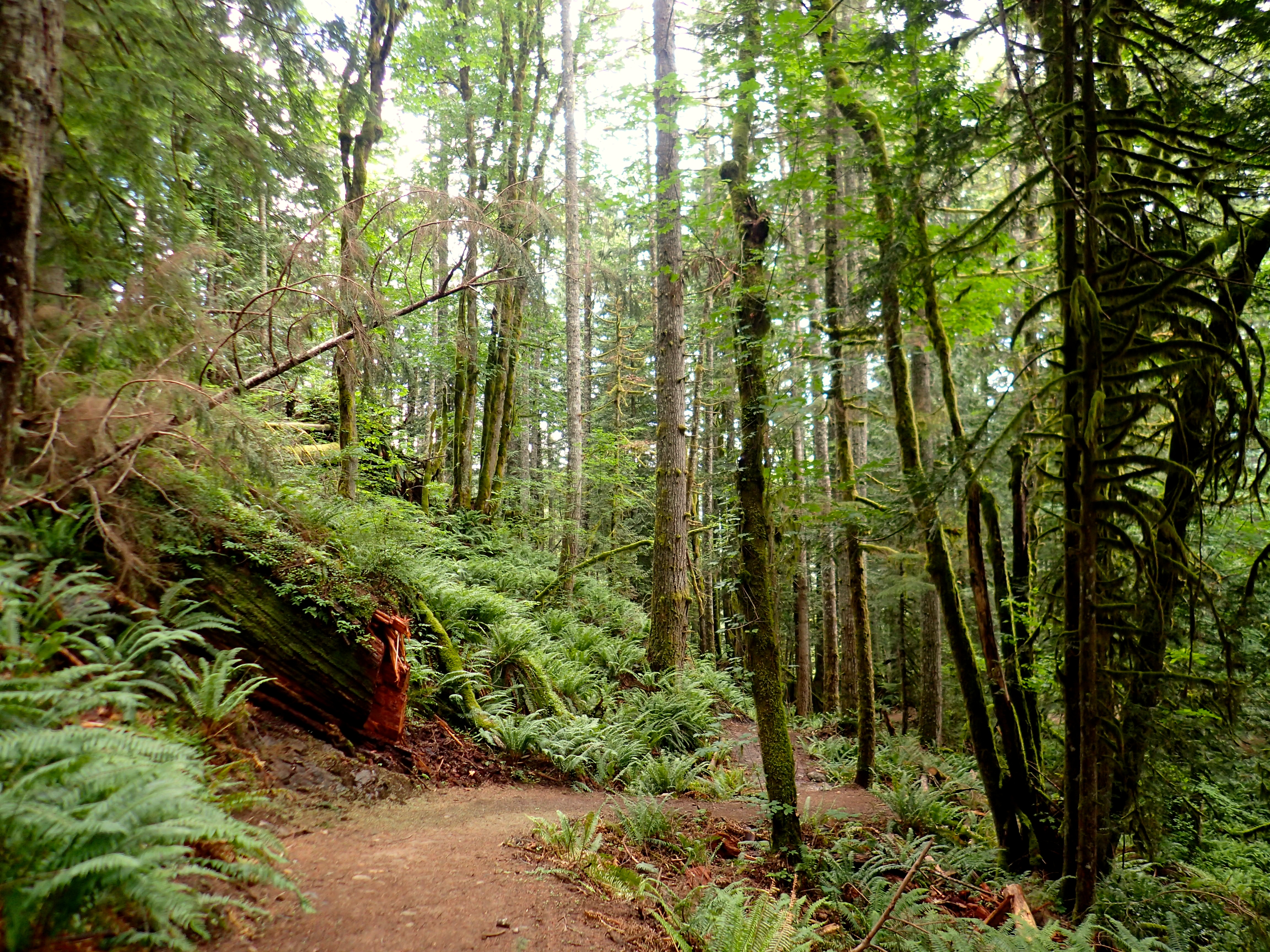
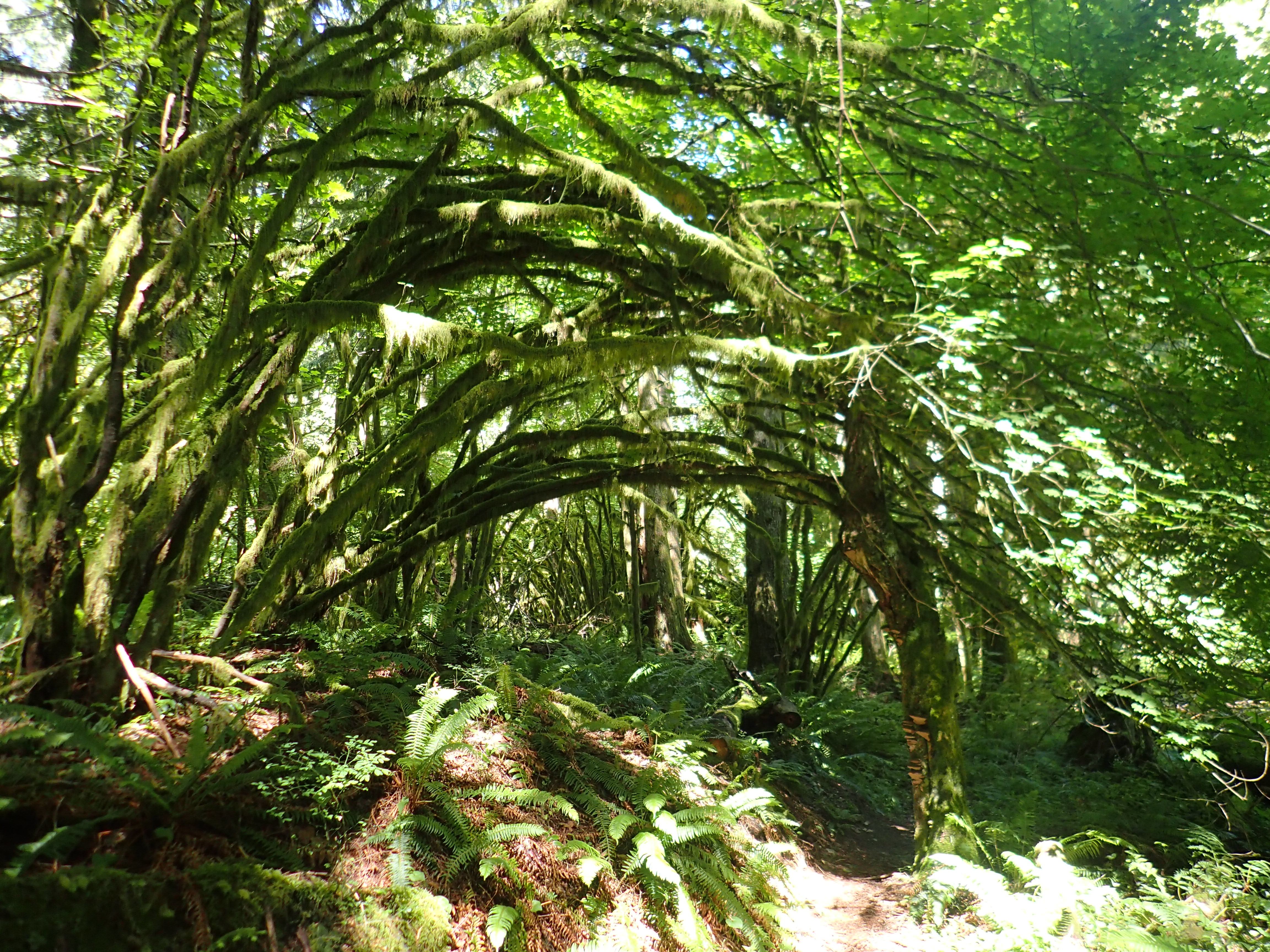
The old trail up Mailbox climbs 4,000 feet in 2.5 miles. I was excited to be out in familiar mountains, and settled into a comfortable clip up through classic Northwest conditions—cool, humid fog, swirling amidst all the ferns and moss and fabulously towering trees. Be still, my heart, I whispered.
The summit of Mailbox, shrouded in mist, was absurdly crowded. (1 p.m. on a Saturday; of course it was!)
I didn’t spend much time up there before descending again, flying back down through the foggy forest. Back at the trailhead, I pulled out my paper map and had zero idea of which direction I was supposed to go next. A fellow runner I’d chatted with a bit near the summit saw me walking somewhat aimlessly down the Middle Fork Road and offered to give me a ride to my next trailhead. (I’d given him a vague description of what I was attempting.)
“Oh no,” I said. “ That would be cheating!” Also, I had no idea yet where my next “trailhead” was. I was still figuring that one out.
“Well, can I at least give you some food?” he asked. “I have tons of snacks in my car!”
“Thank you, but I can’t take those either; I’m all set!” I told him brightly, gesturing to my pack. Its mesh side pockets bulged with snacks of my own.
He kindly waved me off and wished me well, while I continued plodding down the road, hoping I was going the right way. (My sense of direction is truly atrocious.) Soon, though, I spotted an unmarked trail that roughly corresponded with the dotted line on my map. Off I went.
For the rest of my journey, I’d run with my map in hand, deriving a shocking amount of pleasure and satisfaction from the act of route-finding via paper maps. As though I were a child on a treasure hunt, waves of glee roared through me every time I managed to find the next trail. George had had me program maps of the first half of the route into an app on my phone, too, so I could periodically double check that I was on course via GPS—though I relegated such checks to rare occasions so as not to unnecessarily drain my phone battery.
The connector trails to Teneriffe were filled with fresh bear scat and lined with copious berry bushes and stinging nettles. After some gentler-grade climbing and cruiser service road, I filtered water for the first time. It took me nearly 20 minutes to eke out 2.5 liters. (Perhaps my filter was overdue for a cleaning? Whoops.)

Next up was the trail up to gorgeous Teneriffe Falls—then the super steep, scrambly push to the summit on an unmaintained trail, which is by far the most leg-muscle-devastating section of the entire Issy Alps route. Ouch!

I summited Teneriffe amidst fast-moving waves of fog interspersed with sunny sucker holes before beginning the service-road cruise down to meet the Mount Si Trail. The sun was going down as I was going up, but due to the face of the mountain that the trail is on, it was hard to know whether I would get to catch sunset or not from the top. As I neared the summit, the light made it look as though the trees around me were on fire.
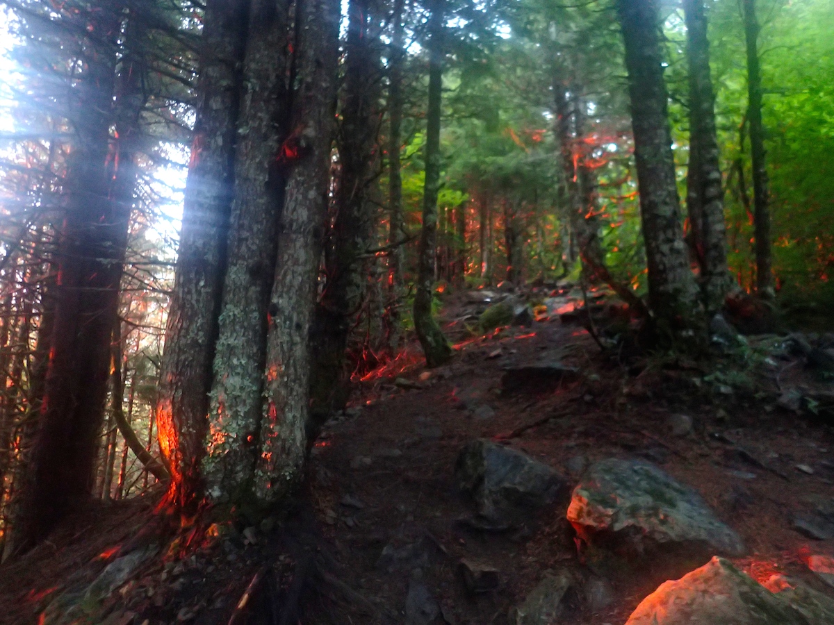
#nofilter
I picked up my pace in the final half-mile, sending my poor heart into an anaerobic fit of desperation to catch that sunset. Just as I was emerging at the base of the boulder field, two hikers were picking their way down. Damn, I thought. I missed it.
“You’re just in time!” they told me cheerfully. “We got up here 20 minutes too soon, and got cold sitting on the summit waiting for the sunset. It’s just beginning now.”
Sure enough, as I got up there, the bottom of the sun had just begun dipping below the horizon.
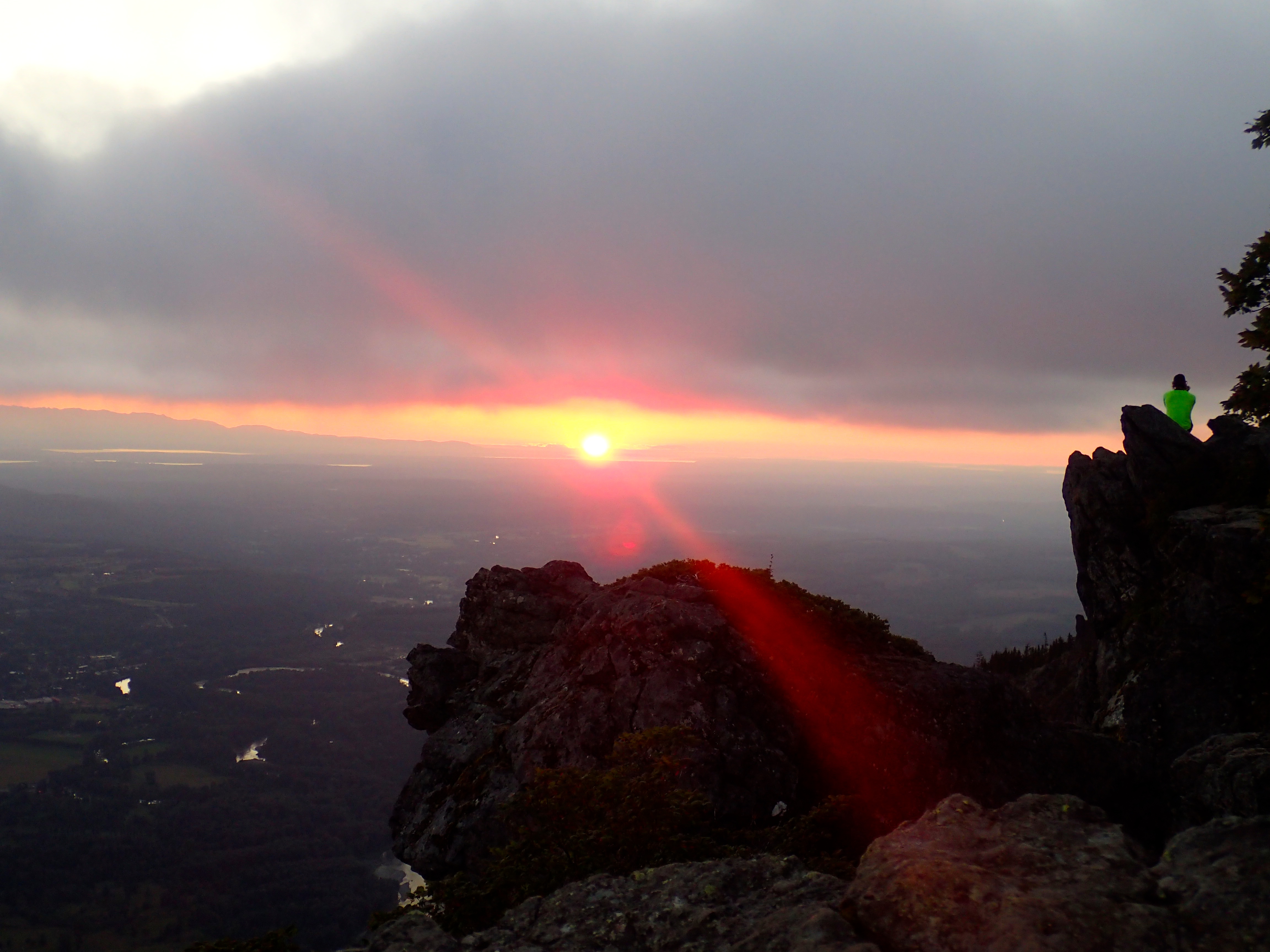
Amidst the clearing clouds, the top of Mt. Rainier off in the distance was bright pink with alpenglow. The skyline of beautiful Seattle was silhouetted against Puget Sound. I waited for the sun to set fully before descending again, barreling down toward my next trail connector over to Little Si. Water-filtering time again.
Atop Little Si, I couldn’t help but spend some time resting with my headlamp off. By then, the sky was dark and clear, the stars out, the lights of North Bend glittering beneath me. I felt at peace.
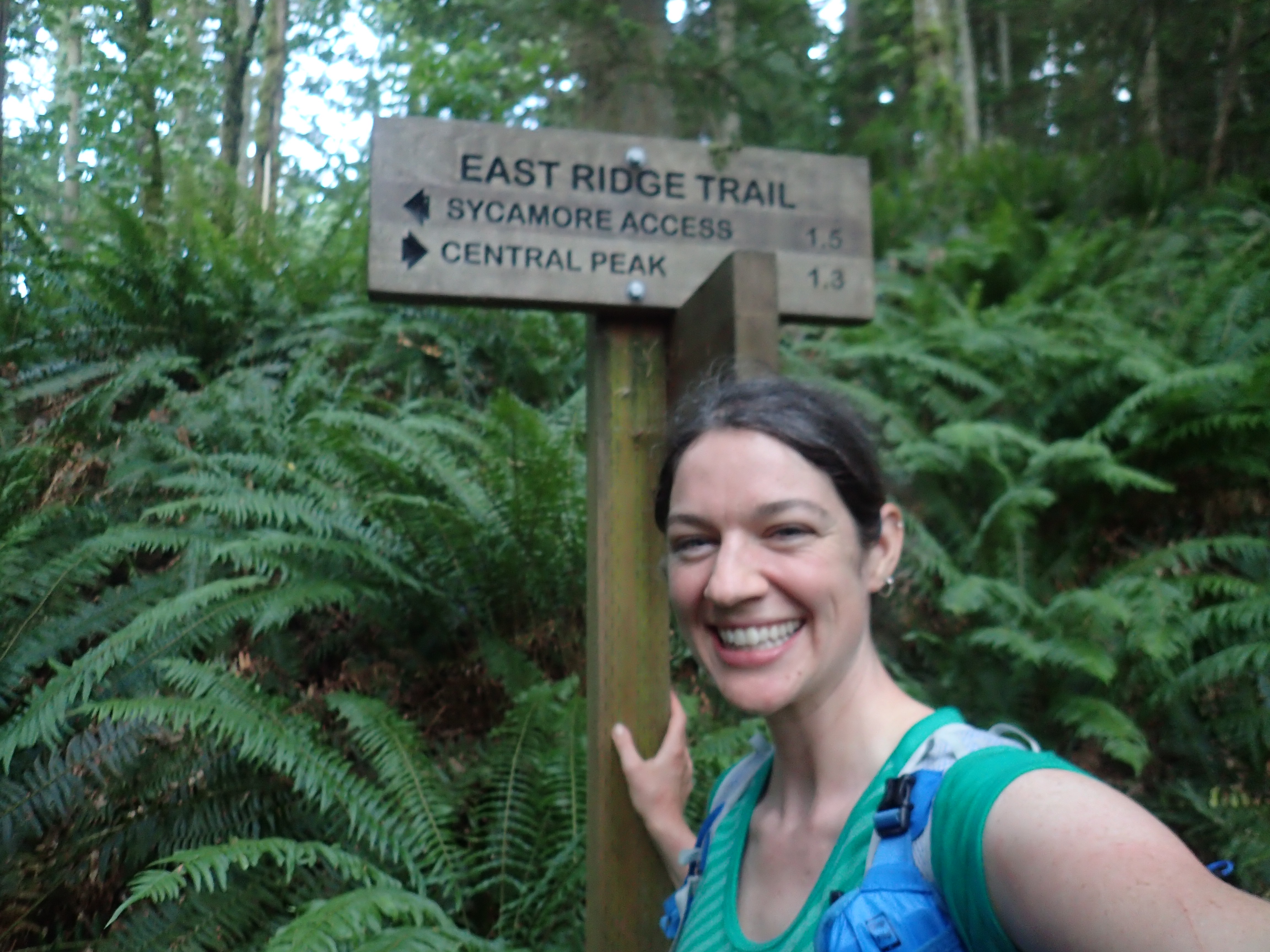
At 1 a.m. (12 hours and 31 minutes into my journey), I hit the Issy Alps 50K mark.
Hell: Rattlesnake to Tiger (to 100K Mark)
The next section is pretty cruiser—six flat miles along the rails-to-trails Snoqualmie Valley Trail. The bullfrogs were noisy here, a tunnel chorus to cheer me on through an otherwise dull (but fast-ish) section of the course. After failing to seal up my water reservoir fully after my last filtering session, I’d unfortunately soaked the bottom of my pack and back of my shorts, leading to a great deal of uncomfortable chafing at this point. Thank goodness for BodyGlide!
I charged up the trail to Rattlesnake Ledge with a great deal of energy. To my surprise, I ran into several hikers coming down from the ledge, despite the odd hours. The first pair of hikers I passed wished me well, telling me excitedly how beautiful the rising moon was, half-full and dark yellow. The second pair of hikers I passed seemed drunk or strung out or just really angry people; upon my greeting them with a cheerful, “Good evening!”, a woman replied to me, “JESUS CHRIST WHY DON’T YOU SHINE YOUR LIGHT IN MY EYES A LITTLE MORE, YOU BITCH.”
That was less than pleasant, to say the least. I tried to shake off the anxiety it provoked in me, but I have to say, most of my traverse of Rattlesnake Ridge was centered around me praying for no more human interactions the rest of the night.
My wish was granted. The traverse was quiet and peaceful, and I was pleased by how early (3:30?) some light began reappearing on the eastern horizon. By the time I reached the Power Lines—my cue to turn off the main trail and start piecing together a bushwhacky traverse over to Tiger Mountain—the sun was on the verge of rising, while the moon still shone brightly.

At this point, I rapidly lost any sign of a trail I was supposed to be following. For hours to come, I wouldn’t really find it again, and here is where the wheels of my Issy Alps attempt didn’t just come loose, but flung off violently in a vortex of failed route-finding and bodily injury.
It’s hard to describe how impenetrable and miserable the overgrowth here was—thick blackberry bushes, saw briars, nettles, the whole bit. And all soaked with morning dew. I knew I needed to follow the power lines down to highway 18, so I wasn’t ever “lost,” per se—but my skin was rapidly getting clawed to shreds as I attempted to plow my way through an utterly trail-less mess of overgrowth taller than myself.
I grew chilled from lack of movement or forward progress. I’d taken a puffy jacket with me, and donned it here for a bit to avoid getting shivery from all the damp plants around me. I put on my full waterproof pants, which helped fend off some scratches, but as the sun came up, I grew clammy and stripped back down to my T-shirt and shorts. (Mistake.)
I finally made it down to the road bisecting Rattlesnake and Tiger and opted to cross the thigh-deep Raging River rather than cross the highway, which was already busy with Sunday morning traffic. The cold river felt remarkably refreshing on my wounded legs, though I don’t think it did my already-blistering toes any favors.
I thought the worst was over, as I found a decent bit of trail heading up Tiger. Unfortunately, though, I quickly lost the trail and once again faced impenetrable briars. I made it to Deep Creek, but not at the place I was supposed to, so I spent the next hour fruitlessly attempting to find a way through the wall of trees and brambles on the other side. Again and again, the land rebuffed me, sending me backward instead of forward.
I took a nasty fall at some point while tottering around on slick, wet branches, banging my leg hard on a rock, plummeting through a canopy of overgrowth and landing squarely in a briar bush with no more clear line of sight to the sky above me. In every direction, I could see nothing but more brambles. My left leg shed some more blood.

I’d like to say I maintained a positive attitude here, buried in the brambles, but I didn’t. Instead, I had a mild panic attack as I dislodged briars from of my broken, inflamed skin. I turned my cell phone off airplane mode to call George, thinking that what I’d probably say to him was “Please send someone to come get me. I am literally stuck in plants and cannot go anywhere.”
But when he picked up, he immediately praised me for how fast I’d been moving, how I was on pace to break the unsupported FKT by more than 24 hours. I told him I was discouraged and freaked out and had no idea where the trail was.
“Is there any kind of trail out here?” I whined.
“Yes, there is,” he told me, and calmly reminded me of something he’d told me before; he’d tied up a couple small green ribbons at the proper place to cross Deep Creek, where there was in fact a faint trail. Encouraged and reinvigorated by the potential to find a trail, I hung up and bushwhacked my way back out to the creek, where I plunged my legs into the icy water for the umpteenth time and marched downstream until I caught sight of the green ribbons I’d somehow managed to miss for the past hour.
Bliss!
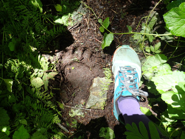
I was back on track. And yet, my hours in the brambles had taken their toll. Everything on me was soaked. I hadn’t bothered to eat anything in hours. My arms and legs were scratched to all hell, my toes and heels blooming with fluid-filled blisters, and the leg on which I’d fallen was so badly bruised that every stride I took made me grunt with pain. By the time I made it back up to a proper trail on Tiger Mountain and sat down to once again filter water and change my socks for the first and only time, I felt that my Issy Alps run was over. My body felt far too battered to continue. I was getting sleepy. Bear tracks on isolated trails put me ill at ease.
It was a slow, miserable hobble up to the East Tiger summit. Bitterly, I thought, Well, Yitka, this is what you asked for! After a string of 100-milers in which I’ve felt surprisingly decent for most of the race, here, finally, was a challenge that had thrown me violently into the pain cave only halfway through. Every step was excruciating—my left hamstring throbbing, my blistered toes in agony. What a shitty sport this is, I thought, grumpy.
At the top of East Tiger, the sun shone brilliantly. Mount Rainier was out in her full glory. I shared the view with a few exhilarated mountain bikers, one of whom I asked to snap my photo. I pretended to look happy.

I spread out all my wet maps and clothes and gear on a picnic table to dry out and sat for a long time, munching away on snacks. I pondered quitting. A few more mostly downhill miles and I’d be at the 100K mark. It wouldn’t count as a 100K finish (by George’s rules, one must complete whatever distance one sets out to run at the get-go in order for it to “count”), but it would at least be a respectable quitting point.
And yet, a part of me already knew that I wouldn’t be quitting.
I hit the 100K mark at 25 hours and 53 minutes. I promptly peeled off my socks and shoes, put my feet up, set my phone’s alarm clock for 45 minutes later and tried to take a nap. I’m not sure if I slept or not; it was the kind of nap in which you never really feel asleep (I was at a trailhead, so people were constantly passing by) but then when the alarm goes off, it nevertheless pries you from some deep, not-quite-wakeful state.
I texted Steve: “I feel like crap. My feet are like raw hamburger. But it’s a gorgeous day, and I still have plenty of time, food and supplies. Resting on Tiger now, will start up again soon …”
I spent 15 more minutes doing serious blister care on my feet with my first-aid kit, all the while still fantasizing about quitting. How could I possibly run 40 more miles when I could hardly even stand up without crying out in pain?
But Ultrarunner Brain scoffed, “40 miles?! That’s not even half of 100 miles! That’s nothing. You’re practically done!”
So off I went again into the woods.
Another Joyful 50K: Tiger/Squak/Cougar/Squak
I was miserable at first, but as I slowly picked my way over West Tiger Mountain summits 3, 2 and 1, I felt my energy and motivation returning. Miraculously, the pain in my lower extremities began subsiding. Objectively, I didn’t feel amazing—but compared to how I’d felt just a few hours earlier, I felt like a million bucks.
By the time I reached Squak Mountain, I was nothing but stoked. I’d gotten a second wind, and though I still had many miles in front of me, I was relieved to be largely done with Tiger Mountain. The section over Squak felt relatively manageable. The trails were better signed here, so I had less anxiety about getting lost. Running on efficient cruise control, I crossed Squak in about two hours as the sun was again setting.

I underestimated the section on Cougar, though, remembering it as a flatter place than it is in actuality. My brain started to get loopy here, too. I’d expected to enjoy this section of very familiar trails, but I did not. It went on and on, and I disliked being alone in the woods while my mind was clearly deteriorating. I felt relief when I finally finished this loop—in about three and a half hours—and got back on Squak.
Now, I was a woman on a mission. I plowed back up Squak with immense gusto. My brain entered all-out storytelling mode; I’ve rarely experienced visual hallucinations during ultras, but boy oh boy does my mind know how to tell itself some wild stories! (In the final miles of UTMB, I was a small-business owner marching up a mountain for the grand opening of a bank that I had decided to found.) On Squak, it was a strange out-of-body experience as my mind divided itself into several distinct personalities, one of whom was running, another of whom was coaching, and several more of whom were on the team, too, (what team? I have no idea!), but unable to do anything but cheer on the runner, who felt like an entity external to myself. I’m probably not explaining this well, but my mind was definitely getting a bit wonky here.
I missed a turn on Squak, running the wrong way briefly on Bullitt Fireplace Trail before realizing my mistake and backtracking. Not frustrated, though. Gleeful. Running fast (relatively). I became aware I might be able to finish this thing in 40 hours, which was the precise time that, weeks earlier, I imagined this might take me. (I’d allotted my calories based on that projection, assuming 200 calories/hour, so having taken a total of about 8,000 calories in my pack from the start.) I tucked my poles away in my pack for good and started really hauling ass then.
I flew back down through the neighborhood at the base of Squak, crossing the road back over to Tiger. I knew time would be tight to make 40 hours, but my legs felt fresher than ever with the excitement of smelling the barn now. I cruised on to the Rainier Trail and sprinted past the turnoff for the High School Trail where I’d come down about eight hours earlier.
Batshit Crazy: The Last Few Miles
And then things got confusing. I wouldn’t realize it until later, but I would soon make a wrong turn. I followed signs saying “Trail Access” thinking they would lead me to the Brink Trail I needed—and soon, I was on singletrack that felt like it was going in the right direction. It was climbing a fair amount, but I managed to maintain a solid running clip. It was just after 3 a.m. and I had 20 minutes to reach the finish. It felt within reason.
Then, abruptly, a set of yellow-green eyes caught in my headlamp. The eyes were low to the ground in the bushes on the side of the trail, about 15 feet ahead of me. I stopped dead in my tracks, not yet sure what I was seeing. The eyes began rising, slowly, and as I trained my headlamp on them, I saw the creature in its entirety—my first mountain lion sighting in the wild.
It had slowly risen from its low position to a standing one on all fours, but otherwise it did not move toward me or make a sound. It just stared at me passively. I immediately began backing away, down the trail I’d come up. Conventional mountain-lion wisdom says that you’re supposed to put your hands way above your head and make lots of noise, but I don’t think I did either of those things. I did put my hands up, but near my face. I didn’t say a word, my breath caught in my throat. But neither did I turn my back or run; I backed away, slowly, slowly, slowly, until I was far enough down the trail that it was out of my sight. I pulled my trekking poles back out of my pack, clicked them into place. Then I backed down some more. And then, finally, I turned and ran, stealing glances back over my shoulder every few seconds to ensure the cat wasn’t following me.
As far as I could tell, it wasn’t.
When I got back down to the trail junction, I didn’t know what to do. I studied my map, trying to see if there was another way to get to the High Point trailhead. It didn’t seem like it (because, as I would discover later when I reviewed the GPS waypoints that my DeLorme tracker had been sending to the interwebs, I had turned onto a different trail too soon and wasn’t yet on the Brink Trail as I had assumed), but in real life in front of me, I saw another different trail extending in what seemed like the correct direction. So I began walking slowly down it, adrenaline pumping through my system. As I walked, I texted George about the mountain lion, evidently feeling the need to tell someone what had happened.
The trail seemed to be going in the right direction. (In fact, as I’d learn later, I was now properly back on the official Issy Alps route; Mr. Cougar had done nothing but kick me off the wrong trail I’d been on and put me back on track!) It began climbing up through the woods.
Yet, with fear and adrenaline still coursing through me, and because I was now very confused about how my maps corresponded with the trails I was on, I texted George again to say that I probably wasn’t going to make it to the official finishing point at the High Point trailhead. I felt certain I was on the wrong trail, going somewhere other than High Point. (Incorrect.) Turning on my maps app yielded no helpful information about whether I was on course or not, and my phone was now at just 5% battery.
I didn’t have a car or ride awaiting me at the finish; my plan had just been to tag the finish at High Point, then backtrack (walk/run) the last two miles of the route to Kate and Jeff’s house in downtown Issaquah, where I’d been staying. But now that seemed a foolish plan. I was ready to be out of the woods, none too eager to do any more bonus miles; I knew I’d already run more than 100 by now and my mind had simply lost its will to navigate.
Then, abruptly, there was a loud rustling in the woods behind me. It didn’t sound especially close, but it spooked me into an instant frenzy of banging my poles together. I swung my headlamp beam around behind me, thinking, Not again! But no beady eyes met me this time. Instead, a headlamp stared back at me. I fell silent. For several seconds, this stranger and I stared at each other, unmoving, assessing one another. In my memory, I could see the man’s outline and it appeared that he was holding a large trash bag, which he abruptly dropped. (I acknowledge it’s possible my loopy mind contrived the trash bag.)
Then, suddenly, the man began moving toward me very rapidly, crashing through brush to do so. My heart began pounding again. I was confused. Where had this person come from? I hadn’t passed anyone on the trail—then suddenly someone appears out of nowhere behind me? It didn’t make sense. And now he was coming toward me, fast. The very last thing in the world I wanted now as an encounter with a strange man in the dark woods.
My instinct was to hide. I snapped off my headlamp and dove off the trail into some nearby bushes, crouching behind a large tree trunk. I suppose I hoped he’d move right on past me on the trail, thinking I’d continued up it. Instead, some 15 seconds later as he came even with my “hiding spot” next to the trail, he turned to stare at me. He flooded me in his headlamp beam.
“Hi there,” he said, continuing to stare.
I’d never felt so terrified and vulnerable.
“Hi,” I mumbled back.
He stared for a few more seconds before moving on, continuing on up the trail and leaving me alone. I exhaled, leapt back up to my feet, and dashed at a full sprint back down the trail I’d come up.
I’m done, I thought. I had no idea who or what this man was; my mind immediately went to He’s out here burying a body. (If you think I’m being dramatic, bear with me; I hadn’t really slept in nearly 44 hours at this point. Also, I couldn’t help but recall that in 2012, just days after George and I had embarked on an epic, bushwhacking, Issy-Alps-route-scouting adventure on Rattlesnake Ridge, police discovered murderer Peter Keller hiding out in a hidden bunker in the woods on Rattlesnake.)
Now, in retrospect, I acknowledge that the stranger I encountered was probably harmless—either a nighttime adventurer just like myself, or perhaps a homeless person or vagrant from the newly erected tent city at the High Point trailhead. However, at the time, all I could think was, Two signs from the universe in less than a mile that I should no longer be out in the woods by myself right now. I hear you, universe; I’m retreating!
Kate and Jeff’s house was less than a mile away. When I reached it and silently let myself inside, all the adrenaline and fear and (most of all) anger broke loose inside of me like floodgates bursting. I was surprised by the ferocity with which deep, scared sobs came out of me. I could scarcely handle the emotion of having spent 99 miles feeling strong and brave and empowered, then in a single mile, all of that crashing down into the exact opposite sentiment—a thick, ugly soup of fear that screamed, “I’m never running alone in the woods ever again!”
Final Reflection
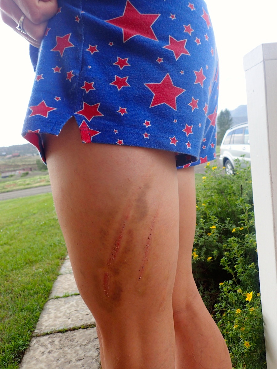
One week later: Issy wounds still healing.
More than a week has now passed since all this. Since then, four other people (two separate teams of two) have also had mountain lion sightings on the course, albeit theirs on a different section than mine. Three other attempts were made on the 100-mile course within the past week, but for various reasons, none of us made it to the finish. George summed it up well when he said that Issy just hasn’t been playing very nice lately.
I do feel better now, calmer and more rational about everything. (Physically, my body’s also still recovering; for the first time ever, I lost a toenail!) As I’ve written before, I am naturally a risk-averse person. I felt anger that night/morning because I didn’t want my experience in the final mile of my Issy Alps—mostly my run-in with the two-legged critter, not the four-legged one—to rob me of my confidence to venture out alone in the mountains. I’ve spent years and many efforts cultivating that confidence, bit by bit. It’s been hard earned.
Many of the finest moments of my adult life have been on solo adventures in the wild, and it is hard to imagine my life void of such experiences.
A week is not long enough to gauge what impact, if any, this experience will ultimately have on me and my approach to the outdoors. In the meantime: I don’t think I’m (too) upset that I didn’t officially finish the complete route. As the birds began chirping outside the window of Kate and Jeff’s guest bedroom that Monday morning and I slipped at last toward sweet sleep, I felt such a profound sense of relief and gratitude for the precious gift of life. I knew George and his purist ethic regarding the rules of the Issy Alps route well enough to know that my adventure would be deemed a DNF, not a finish—but, truly, that didn’t matter to me then, and it doesn’t matter to me now, other than feeling a little guilty for possibly disappointing others. (I feel far more guilty for worrying people who care about me by continuing to embark on the unusual jaunts that I do.)
On a personal level, though, I feel richly satisfied with what I accomplished out there. I’m grateful to George for putting together such an epic challenge and inspiring so many of us to get out there and attempt something big. And I am grateful, at least, for the first 99 miles. They are miles that, whether blissful or painful or somewhere in between, embodied everything I love about ultrarunning, about finding strength within oneself, about seeking challenges and enduring when the going gets tough, about mountains, about tall trees, and about my beloved Pacific Northwest.
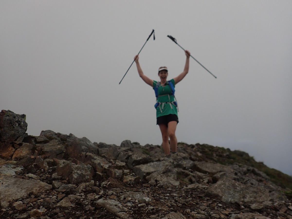
Atop Mount Teneriffe
Gear I Wore/Used/Consumed:
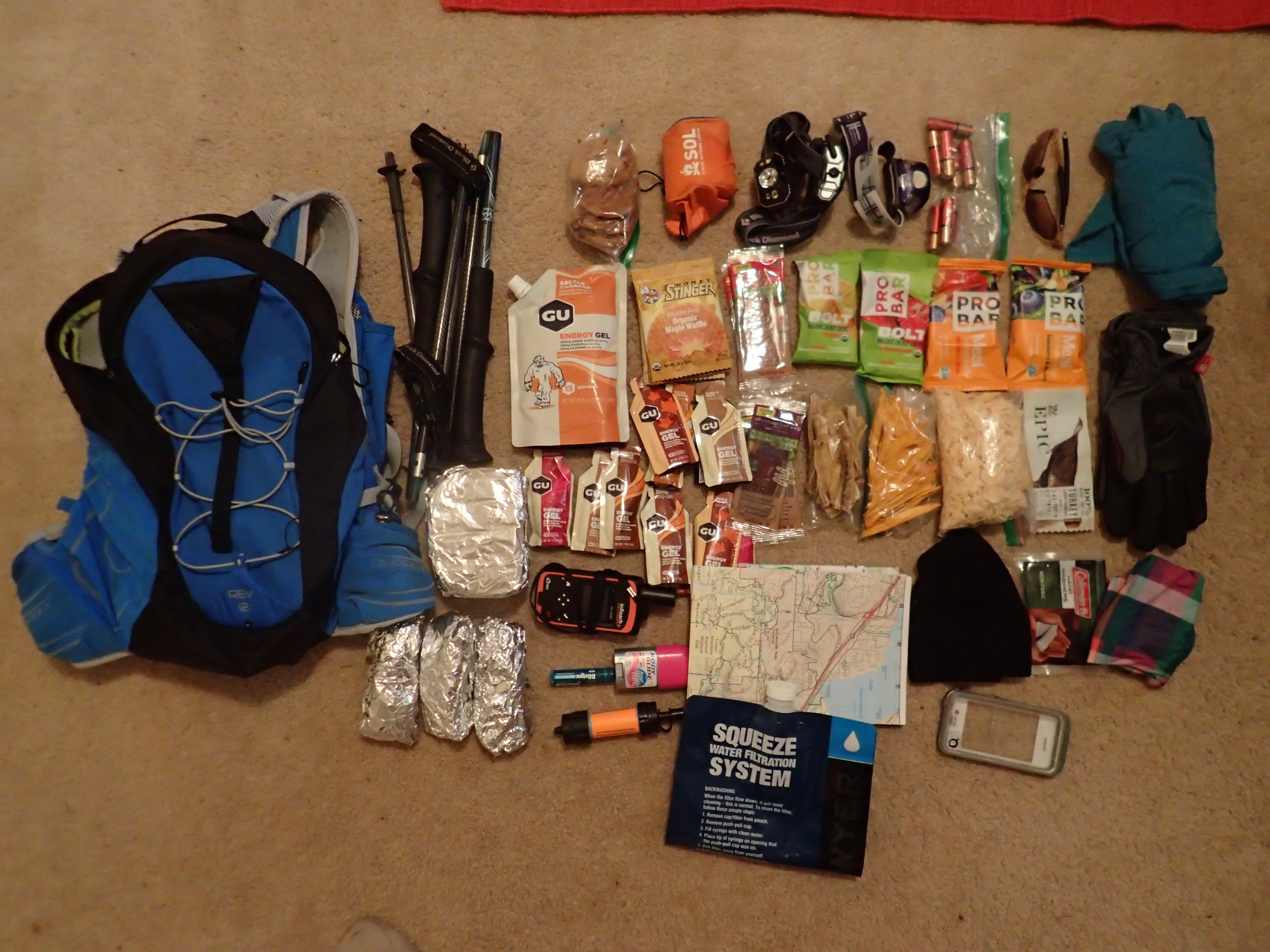
A not-quite comprehensive photo of my gear assortment
- Osprey Rev12 Pack with 2.5-liter water reservoir
- Sawyer Mini Squeeze Filter
- Black Diamond Z-Pole trekking poles
- Black Diamond Icon Headlamp
- 3 sets x 4 AA batteries (only needed 2 sets; 1 per night I was out)
- PEP Bristow short-sleeve shirt (merino wool)
- Pearl Izumi running shorts
- Pearl Izumi N2 V3 Trail shoes
- 2 pairs tall Injinji socks (I changed socks once, shortly after Deep Creek crossing on Tiger Mountain)
- Montbell Peak Shell waterproof pants (Wore these briefly on power lines section coming off Rattlesnake)
- The North Face Thermoball jacket (Probably would have been fine without this, but I do get cold easily and wanted it just in case; I did wear it for about an hour early on Sunday morning)
- Tifosi Wisp sunglasses
- Headsweats running cap
- Olympus Stylus Tough TG-4 Digital Camera
- iPhone in LifeProof case; PDF Maps app with Caltopo maps of first half of of Issy Alps route (Mailbox—Rattlesnake) preloaded
- 4 GreenTrails paper maps: Mt. Si, Rattlesnake, Tiger, Cougar/Squak
- Blistex chap stick
- Mini tube of sunscreen
- Mini BodyGlide stick
- Extra Ziploc bags, toilet paper and mini 1st-Aid Kit
- DeLorme inReach Explorer (not for navigation, but for others to track my location online; and SOS button/functionality in case of emergency)
- 2 Ziploc bags of dehydrated mango and banana slices (5 mangos and 3 bananas); 8 fruit leather strips; 1 can of Pringles chips crushed into a Ziploc bag; 2 Epic bars; 1 bag beef jerky; 4 Honey Stinger waffles; 3 avocado/tortilla wraps; 2 almond butter/banana sandwiches; 1 lb. bag GU + 12 GU packets; 2 PRO BAR meal bars; 3 bags PRO BAR Bolt chews; 4 homemade chocolate chip cookies; 1 CLIF bar; Gin Gins (I did not eat all of this; at the end, I probably still had about 1,500 uneaten calories left over in my pack)
Things I Packed and Didn’t Wind Up Using/Needing, But for the Most Part, Still Glad I Had with Me:
- SOL emergency bivvy
- Spare headlamp (Petzl Tikka) and 1 set AAA batteries
- Mountain Hardwear Integral Pro Long-Sleeve Zip T (merino wool blend)
- Ultimate Direction Ultra waterproof jacket
- Mountain Hardwear Plasmic OutDry waterproof gloves
- Ibex wool cap
- Run Pretty Far buff/neckwarmer
- 1 packet handwarmers
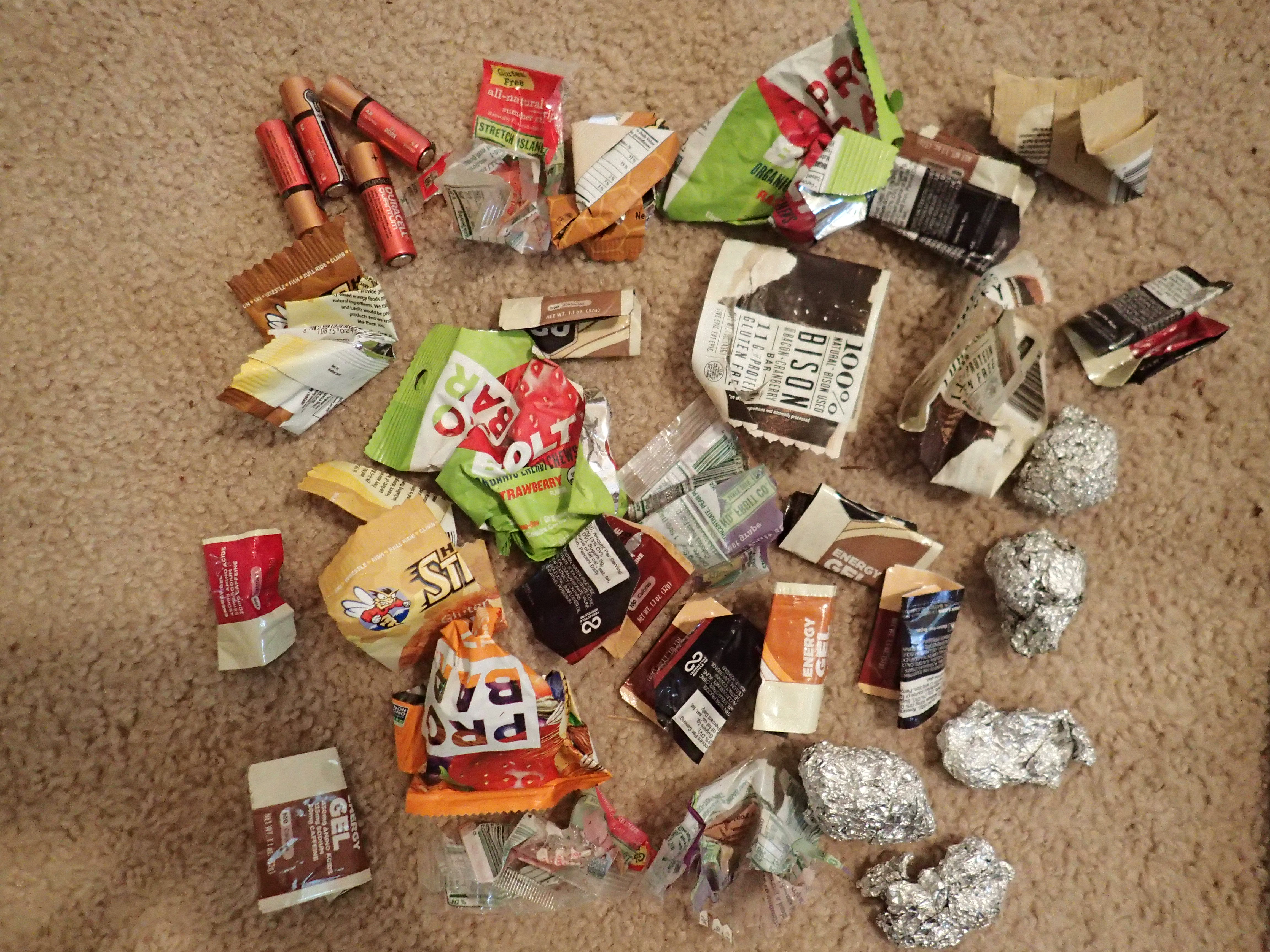
All my trash I packed out
Gear Choices I’d Do Differently Next Time:
- Instead of a full long-sleeve shirt, pack arm sleeves to wear at night (assuming similar weather forecast) and through nettles/brambles sections.
- Bring SteriPen or rig up an inline filter instead of using squeeze filter for time efficiency. I probably spent at least 1.5-2 hours of non-moving time filtering water along the way.
- Bring more crushed potato chips and meat/jerky. I brought a lot of sweet things, not enough salty.
- Pony up for higher-quality aluminum foil; foolishly, I bought the cheapest, off-brand foil at the grocery store, and it came close to disintegrating amidst all the jostling in my pack—no fun picking out foil flecks from my avocado wraps and sandwiches.
- Bring pepper spray and/or a knife.
Thanks for all the nitty gritty details! This route has intrigued me and intimidated me for a couple of years, it’s that crossover from Rattlesnake to Tiger that has me worried. So glad you rallied! And I’m impressed by how many second winds you got… amazing. And that “trees on fire” pic from Mt Si? Wow!
Overdue thanks for your comment, Martin! Yes, before I give this one another go in future years I’ll have someone take me on a little recon mission for that crossover. It’s funny that that’s where I struggled most, since George and I originally scoped out that transition for the Issy Alps route together in 2012. But apparently four years is enough time for memory to fade!
Great read Yitka–as usual. Still waiting for my first “cat” encounter (preferably not at night and not in close quarters). Love the pics and another wow on the fire picture. You are one tough nut. Congrats on a well-fought battle.
Overdue thanks for your kind words, Kendall! I’m amazed that, in all the hours you spend out in the mountains doing epic stuff too, you’ve never had a cat encounter! Just goes to show those creatures sure do know how to keep themselves disguised if they want to. Here’s to hoping I don’t have another one for a long time coming. 🙂 (Though I admit now, with the comfort of hindsight, I am grateful for the opportunity to have seen one up close.)
Yitka – you are a ROCK STAR my friend. Great overview of a pretty Epic run!!!
You are just the inspiration (and education!) I needed right now. Way to go Yitka!!! You really are amazing!
This is fascinating and inspiring! I just rediscovered your blog after a few years. Let me know if you’re ever in London! 🙂
Thanks, Helen! I will let you know next time I’m bound for the other side of the pond. 🙂
[…] take the opportunity to read Yitka’s fantastic tale of an epic 100 miler through the “Issy Alps” where she encountered more vert than Hardrock, tough briars, […]
Yitka, I loved your account and am in the dream state of
“Should I shouldn’t I”. BTW I was one of the photography ‘students’ at the Trail Runner Photocamp in Ouray last year. Loved hanging with you. I am launching Light In A Spoon Productions and getting out
On the trails right now to capture images for our web site and fb.
Hi Greg! Of course I remember meeting you at camp last year! Congrats on launching your production business. I’ll look forward to following along with your adventures. Your website and blog look great.
Congrats on taking the red pill. 😉
Wow. What an adventure!
Nice writing. I did the 100k route this year and could give you some tips on how to navigate the section between Rattlesnake and tiger without getting to scratched up and saving you a lot of time. Good job on what you did out there. Please continue to adventure your dreams.
Someday I hope to have as magnificent a DNF as you have!
That was as great as I had hoped, that read would be.
Now, I want to try it too. Hoping to do the first 50 K, soon.
Belated thanks for your kind words, Trevor.
I’ll look forward to hearing about your 50K if/when it happens!
I have always been scared to meet a mountain lion, and it is amazing that you did and kept your wits about you and escaped unscathed! This is confidence inspiring, that there are legitimate encounters that end mildly. I really laughed when you met the guy on the trail, I am sure I would have reacted the same way! Great job, that sounds like an epic.
Jenny, thanks so much for reading and taking the time to comment! I couldn’t decide whether my mountain lion experience gave me more confidence (confirmation of the fact that most sightings or encounters don’t ever turn aggressive) or took it away (now I’m always going to be paranoid when running in the woods at night!) … but the more time passes since this experience, the more I lean toward the former. 🙂
Looking forward to checking out your blog. Thanks again for saying hi.
[…] the broad daylight here I could not help but think of Yitka Wynn’s experience. Yitka may have been the last person to attempt this as a solo unsupported run and she did this […]
[…] Grand Canyon 6 times in a continuous push, and the other has climbed Mt. Everest. Another person, Yitka Winn, made it 99 miles but her attempt ended abruptly at 3am, one mile from the finish, due to…. A 4th person, Richard Kresser, recently did the route backwards but had to skip a hill near the […]
[…] history of the Issy Alps 100 route (you can find that here), nor my own personal history with it (story of my first DNF here; shorter post on my second DNF here)—but suffice to say that in six years, the route had 15 […]
[…] She wrote very compellingly about fear and adventure in the mountains we love so much. http://yitkawinn.com/2016/07/my-99-mile-dnf-running-the-issy-alps-100/ I had already run my own variation on a 50K in the Issy Alps, and in the wake of my DNF at Thames […]
Wonderful write up – so much of it sounds familiar! We bushwhacked horribly near Deep Creek on my 2nd attempt.